Military Map: Frog's Point to Croton River (1776)
Military Map: Frog's Point to Croton River (1776)
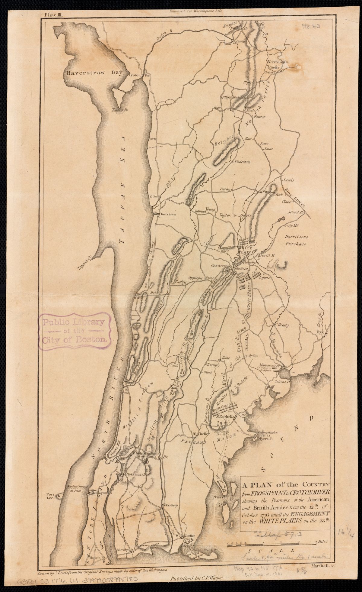
Revolutionary War map showing American and British army positions from Frog's Point to the Croton River, October 12-28, 1776. Shows the Croton Ferry crossing and military fortifications in the Neutral Ground.
Date: 1776 Location: Westchester County, NY (Frog's Point to Croton River) Type: map Subjects: river, bay, heights, military positions, Croton Ferry Source: Leventhal Map Center, Boston Public Library License: No known copyright restrictions