Hydrographic Map Showing Line of Croton Aqueduct (1846)
Hydrographic Map Showing Line of Croton Aqueduct (1846)
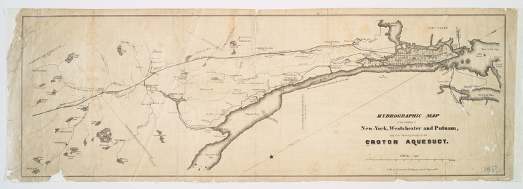
Detailed map from the NYPL Map Division showing the complete route of the Croton Aqueduct from the Croton Dam through Westchester County to Manhattan. Compiled under the direction of chief engineer John B. Jervis. Shows the relationship of the aqueduct to rivers, hills, and settlements along its 41-mile route.
Date: 1846 Type: map Subjects: Croton Aqueduct, rivers, hills, settlements, Westchester County, Manhattan Source: NYPL, Lionel Pincus and Princess Firyal Map Division License: Public domain