History /
Archive /
crotonhistory.org — https://crotonhistory.org/2013/06/13/u-s-geographical-survey-map-1943/
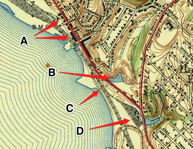
U.S. Geographical Survey Map, 1943
U.S. Geographical Survey Map, 1943
U.S. Geographical Survey Map, 1943
This article examines a 1943 topographic map of the Haverstraw Quadrangle, surveyed in 1938 by the U.S. Department of the Interior Geological Survey. The map reveals Croton's landscape before Route 9 construction.
Key observations include: "All but one of the buildings on the west side of Riverside Avenue were torn down when Route 9 was built." The surviving structure is the former Croton train station, now occupied by F.A. Burchetta Co.
A pond shown in the
Date: Various Source: crotonhistory.org — https://crotonhistory.org/2013/06/13/u-s-geographical-survey-map-1943/ License: Used with attribution; consult crotonhistory.org for permissions