Sanborn Fire Insurance Map — Croton-on-Hudson (1911)
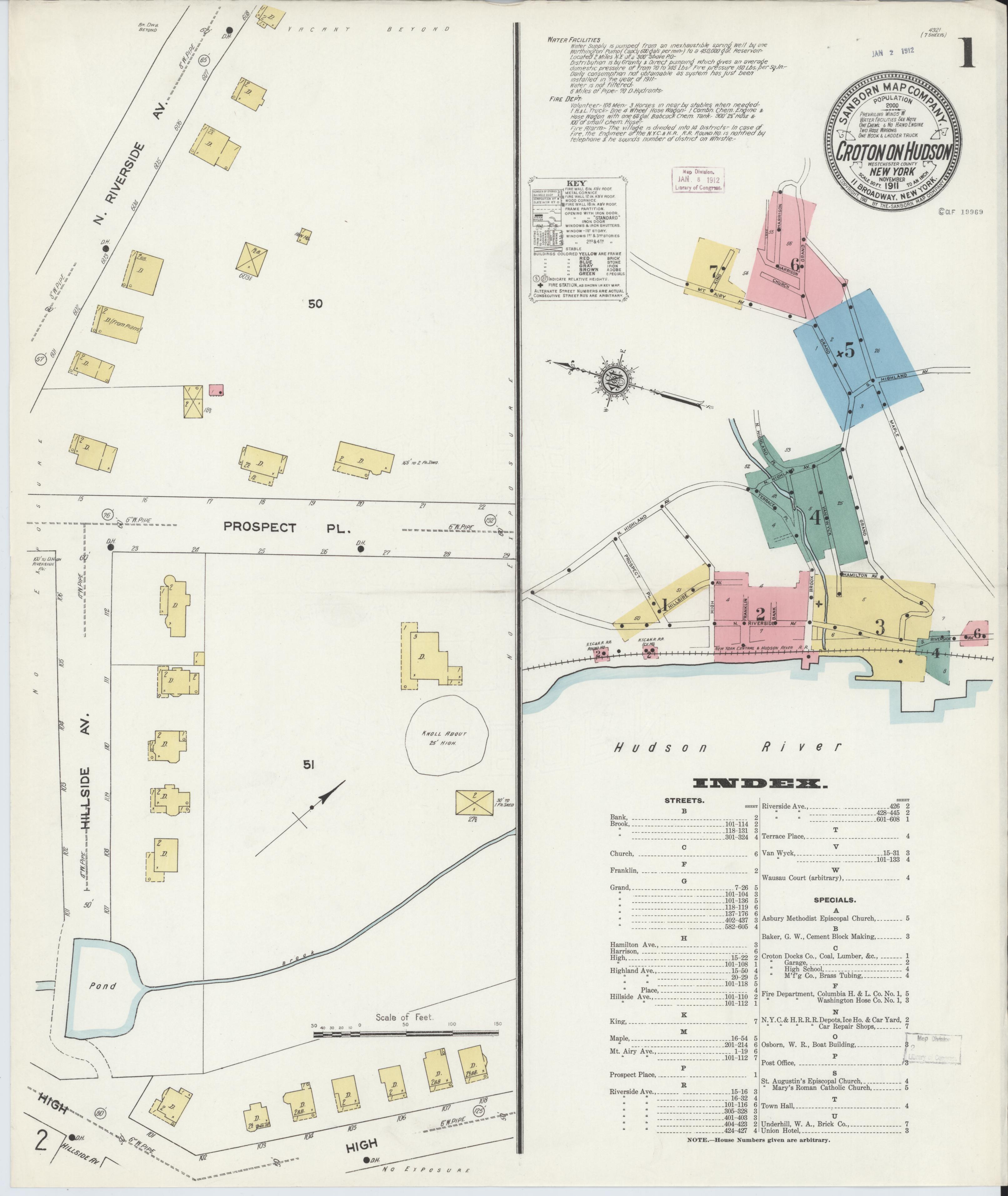
Sanborn Fire Insurance Map — Croton-on-Hudson (1911)
Sanborn map from 1911, five years after the completion of the New Croton Dam. Shows how the village had changed since the 1903 edition — new buildings, expanded infrastructure, and the impact of the dam workers who had settled permanently in the area.
Date: 1911 Location: Croton-on-Hudson, NY Type: map Subjects: Croton-on-Hudson, Hudson River, buildings, streets, infrastructure Source: Library of Congress, Geography and Map Division License: Public domain