Profile of Lower Part of Croton Aqueduct — Jervis/Schramke (1843)
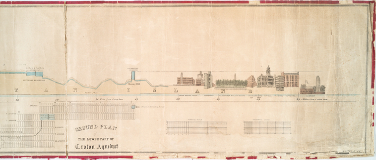
Profile of Lower Part of Croton Aqueduct — Jervis/Schramke (1843)
Engineering profile drawn by Theophilus Schramke under the direction of chief engineer John B. Jervis, showing the elevation changes along the lower portion of the Croton Aqueduct as it approached Manhattan. The aqueduct descended by gravity from the Croton Dam at 166 feet above tide to the receiving reservoir at 115 feet — a remarkably gentle grade over 41 miles.
Date: 1843 Type: engraving Subjects: Croton Aqueduct, map, engineering profile, buildings, structures Source: NYPL, Lionel Pincus and Princess Firyal Map Division License: Public domain