Restored maps / April 1892 edition · surveyed 1890
Croton area, 1892
Twenty-foot contours, roads, streams and place names before the New Croton Reservoir.
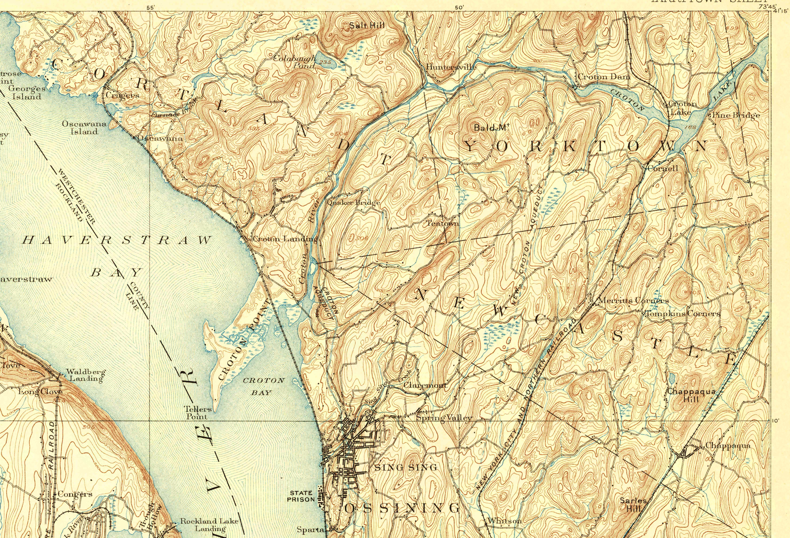
Full source and restored files are available below. JavaScript enables tiled zoom and comparison.
What changed
Adjusted paper tone and lightly strengthened existing ink at the scan’s native resolution. No upscaling or redrawn lettering.
This is the northern Croton-area excerpt. The linked GeoPDF includes the complete Tarrytown sheet and collar. The geographical atlas retains its existing map alignment.
Fading, scan grain and overlapping marks remain visible. Compare the original when a detail is uncertain.
Vector tracing is still being tested; this view uses the processed scan.
Source & inspection
U.S. Geological Survey · Frank Sutton and Robert Muldrow, topography · USGS HTMC. Extracted from the official GeoPDF’s embedded images without resizing; complete original sheet linked below.
Independent review compared 18 areas at native scale, including nine tile boundaries. The processing record lists the exact scope and limits.
Original source catalogue ↗ · Source scan ↗
Native scan excerpt (48.6 MB) · Processed native excerpt (37.2 MB) · Processing & registration record ↗
Retained original checksum
b1ccf4678c615471108b3a82ef2365cbac9d02db23c302e2502fe73ca4f44ce4