History / Search
751 passages in 751 source items for “How Croton Landing met the river”
Collection
All
🏹 Indigenous Peoples & Archaeology
📜 Colonial & Dutch Records
📖 Westchester County Histories
🏘️ Croton Local History
🏛️ Government Documents
No passages matched all of those words — showing passages that match any of them, best matches first.
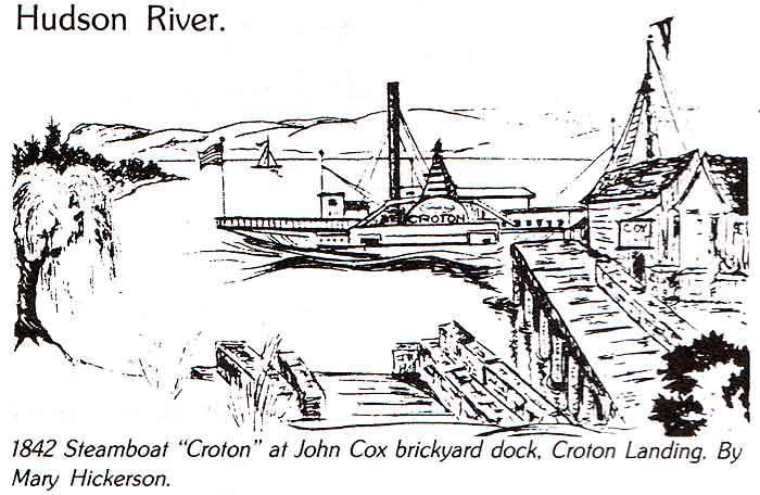
brickcollecting.com — https://brickcollecting.com/croton.htm
John Cox Brickyard, Croton Landing
Historical photograph of the John Cox brickyard at Croton Landing. Cox was one of many brick manufacturers operating along the Hudson River in the 19th century.
Date: c. 1880-1900
Location: Croton Landing, Croton-on…
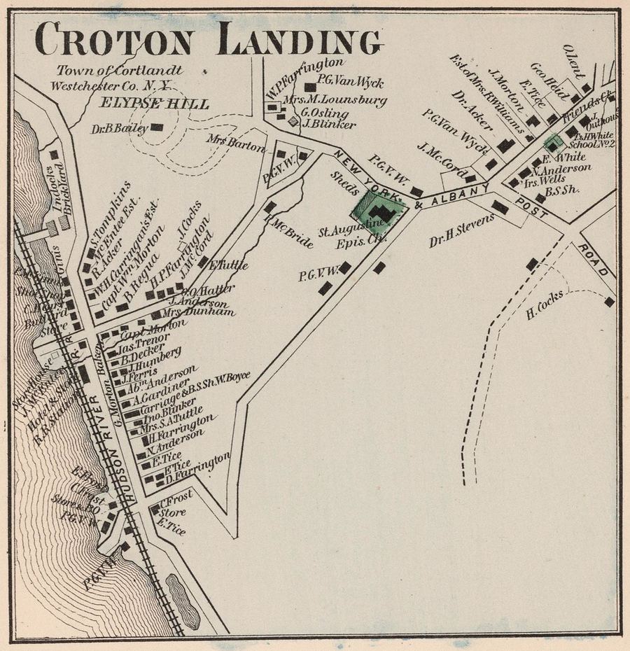
crotonhistory.org — https://crotonhistory.org/2014/01/06/croton-landing-1872/
…The map reveals that Riverside Avenue once ran adjacent to the Hudson River's original banks; the area east of the railroad tracks was subse
Date: Various
Source: crotonhistory.org — https://crotonhistory.org/2014/01/06/croton-landing-1872/
License…
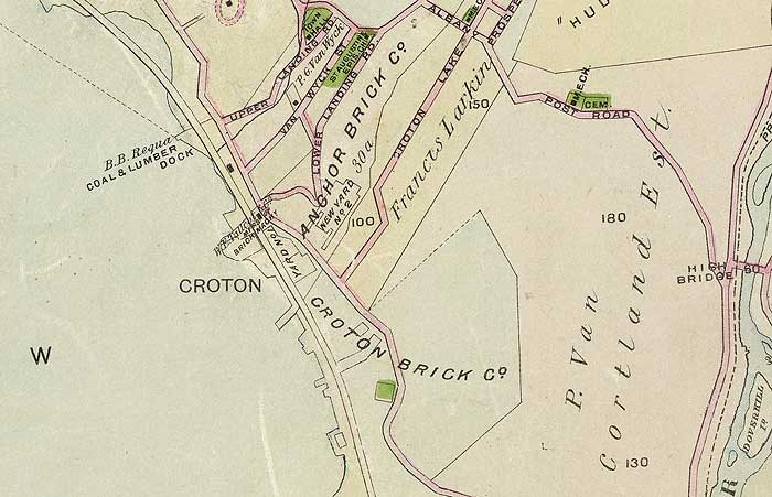
brickcollecting.com — https://brickcollecting.com/croton.htm
…Beers atlas showing the Anchor Brick Co. and other brickyards along the Hudson River at Croton Landing.
Date: 1891
Location: Croton Landing, Croton-on-Hudson, NY
Source: brickcollecting.com — https://brickcollecting.com/croton.htm
License: Public domain map

crotonhistory.org — https://crotonhistory.org/2012/08/01/croton-landing-1881/
Croton Landing, 1881
Croton Landing, 1881
A historical map detail from the Atlas of Westchester County, New York, compiled by G.W. Bromley & Co., Civil Engineers, published in 1881. The image shows Croton Landing as it appeared during that era…

crotonhistory.org — https://crotonhistory.org/2012/03/03/croton-landing-1868/
Croton Landing, 1868
[Article content from crotonhistory.org - see URL for full text and images]
Date: Various
Source: crotonhistory.org — https://crotonhistory.org/2012/03/03/croton-landing-1868/
License: Used with attribution; consult crotonhistory.org for permissions
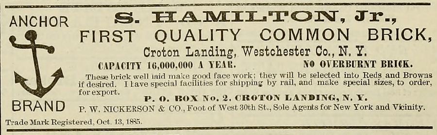
crotonhistory.org — https://crotonhistory.org/2012/03/17/anchor-brand-bricks-at-croton-landing-1889/
Anchor Brand Bricks at Croton Landing, 1889
[Article content from crotonhistory.org - see URL for full text and images]
Date: Various
Source: crotonhistory.org — https://crotonhistory.org/2012/03/17/anchor-brand-bricks-at-croton-landing-1889/
License: Used with…

Library of Congress, HAER NY-132
…1892 and 1906, many of whom settled in the 'Little Italy' neighborhood at Croton Landing.
Date: c.1969
Location: Croton-on-Hudson, NY
Type: photograph
Subjects: dam, waterfall, bridge, stone wall, river
Source: Library of Congress, HAER NY-132
License…

NY Heritage Digital Collections
…Governor Theodore Roosevelt sent the National Guard to Croton Landing to maintain order.
Date: April 1900
Location: Croton-on-Hudson, NY
Source: NY Heritage Digital Collections
License: Public domain

crotonhistory.org — https://crotonhistory.org/2012/11/11/croton-point-1924/
…During the 1930s, an emergency airplane landing strip was constructed.
Date: Various
Source: crotonhistory.org — https://crotonhistory.org/2012/11/11/croton-point-1924/
License: Used with attribution; consult crotonhistory.org for permissions

Library of Congress, Geography and Map Division
Sanborn Fire Insurance Map — Croton-on-Hudson (1911)
Sanborn map from 1911, five years after the completion of the New Croton Dam. Shows how the village had changed since the 1903 edition — new buildings, expanded infrastructure, and the impact of…

crotonhistory.org — https://crotonhistory.org/2013/02/16/esso-happy-motoring-map-1950/
…strategically excluded the railroad—"the arch-enemy of gas companies." However, an anchor symbol beneath "Croton-on-Hudson" indicated seaplane service back to New York City, and a small airplane landing strip existed near the New Croton Dam via Route…

Metropolitan Museum of Art (Open Access, CC0)
High Bridge, New York — Henry Ward Ranger (1905)
Oil on canvas by Henry Ward Ranger (1858-1916) depicting the High Bridge carrying the Croton Aqueduct over the Harlem River. The oldest standing bridge in New York City, High Bridge was…

Library of Congress
Hudson-Fulton Celebration Float — Introduction of Croton Water (1909)
Parade float commemorating the introduction of Croton Water, from the 1909 Hudson-Fulton Celebration in New York City. Shows how the 1842 Croton water achievement was still celebrated 67 years later…
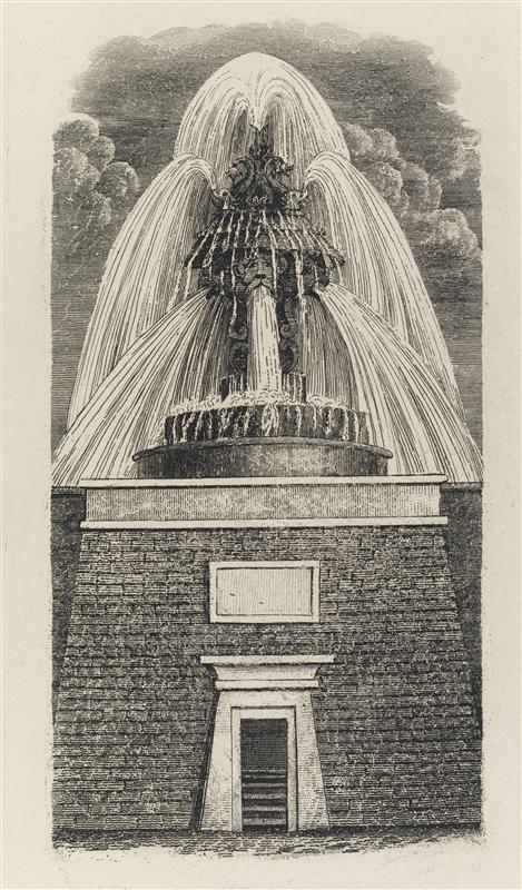
crotonhistory.org — https://crotonhistory.org/2013/05/13/o-blessed-be-the-croton/
…how clean water transformed New York City.
The poem expresses joy about the aqueduct's benefits across social classes. As Child wrote, the Croton "flows for man and beast, and gives its wealth out freely, to the greatest and the…

crotonhistory.org — https://crotonhistory.org/2016/02/14/the-hoity-toitiest-spot-extant/
…His "Wide-Open Spaces Department" captured Depression-era roadhouse culture, describing how drivers of modest vehicles gripped their steering wheels anxiously amid traffic.
James surveyed various establishments across New York City, Long Island, the Bronx, and lower Westchester before concluding…

crotonhistory.org — https://crotonhistory.org/2016/05/21/the-ghost-fleet-1946-1947/
The Ghost Fleet, 1946-1947
The Hudson River National Defense Fleet, officially established by Congress in 1946, served as a reserve of merchant ships ready to support military operations. Located at Jones Point (formerly Caldwell's Landing) near Dunderberg Mountain…

NYPL, Robert N. Dennis Collection of Stereoscopic Views
Croton Dam on the Croton River — Stereoscopic View (1865)
Stereoscopic photograph of the Old Croton Dam, showing water flowing over the spillway. From the Robert N. Dennis collection. This is a rare early photograph of the dam that supplied all…
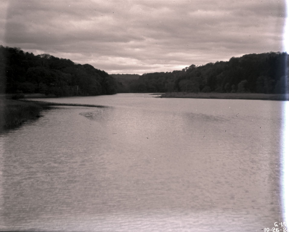
Westchester County Archives, Park Commission Collection
Croton River 1923B
Photograph of the Croton River (1923). From the Westchester County Park Commission Photograph Collection.
Date: 1923
Location: Croton-on-Hudson, NY
Type: photograph
Subjects: river, trees, water
Source: Westchester County Archives, Park Commission Collection
License: Public domain…
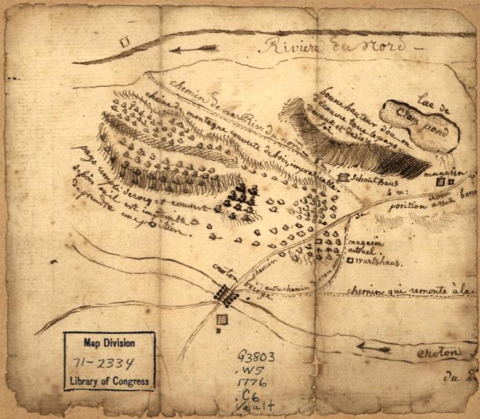
Library of Congress, Geography and Map Division
Country Between the North River and Croton River (1776)
French military manuscript map (pen and ink) from the American Revolution showing the terrain between the Hudson River and the Croton River. Includes military annotations. This area would become the route…
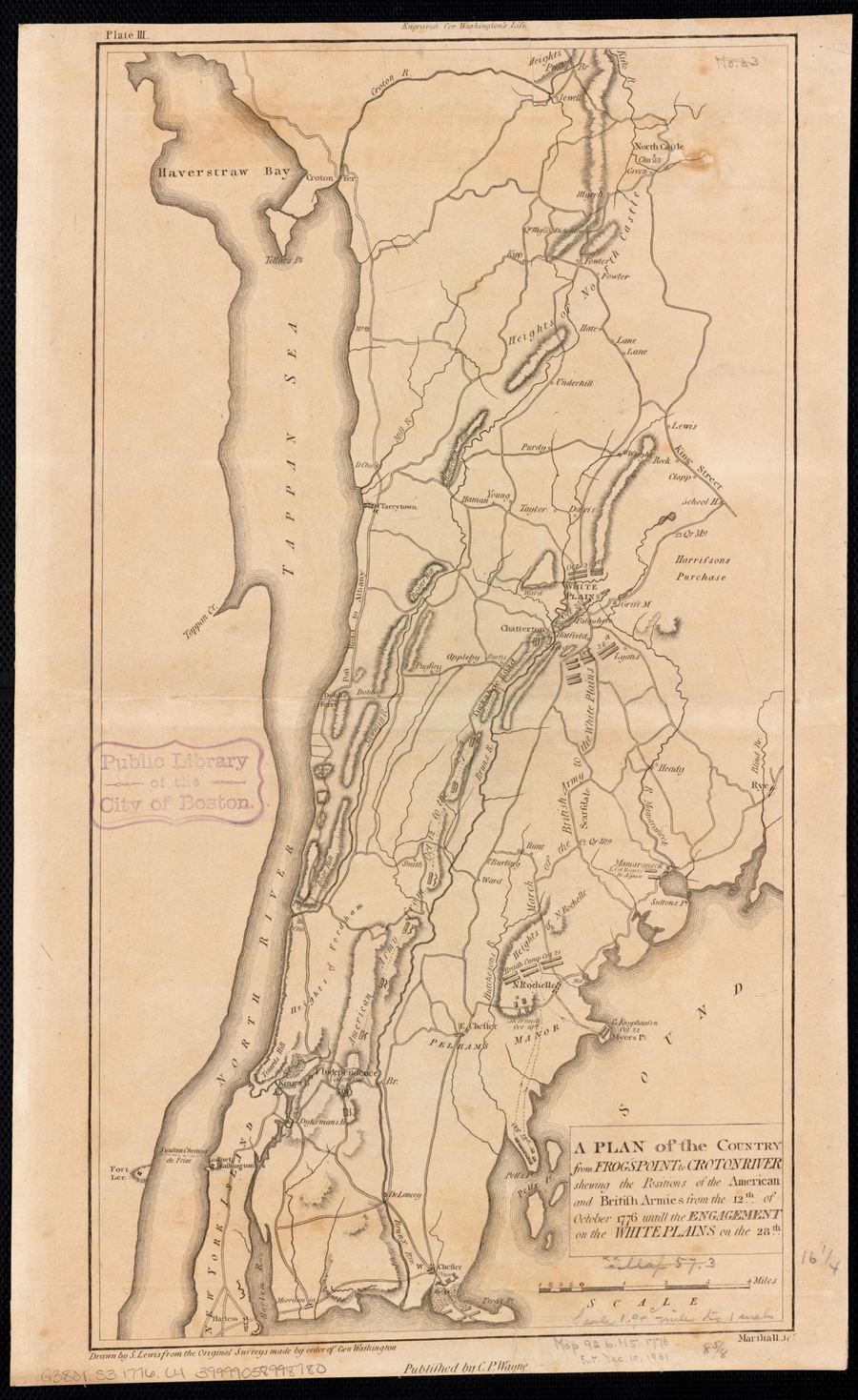
Leventhal Map Center, Boston Public Library
…Frog's Point to Croton River (1776)
Revolutionary War map showing American and British army positions from Frog's Point to the Croton River, October 12-28, 1776. Shows the Croton Ferry crossing and military fortifications in the Neutral Ground…
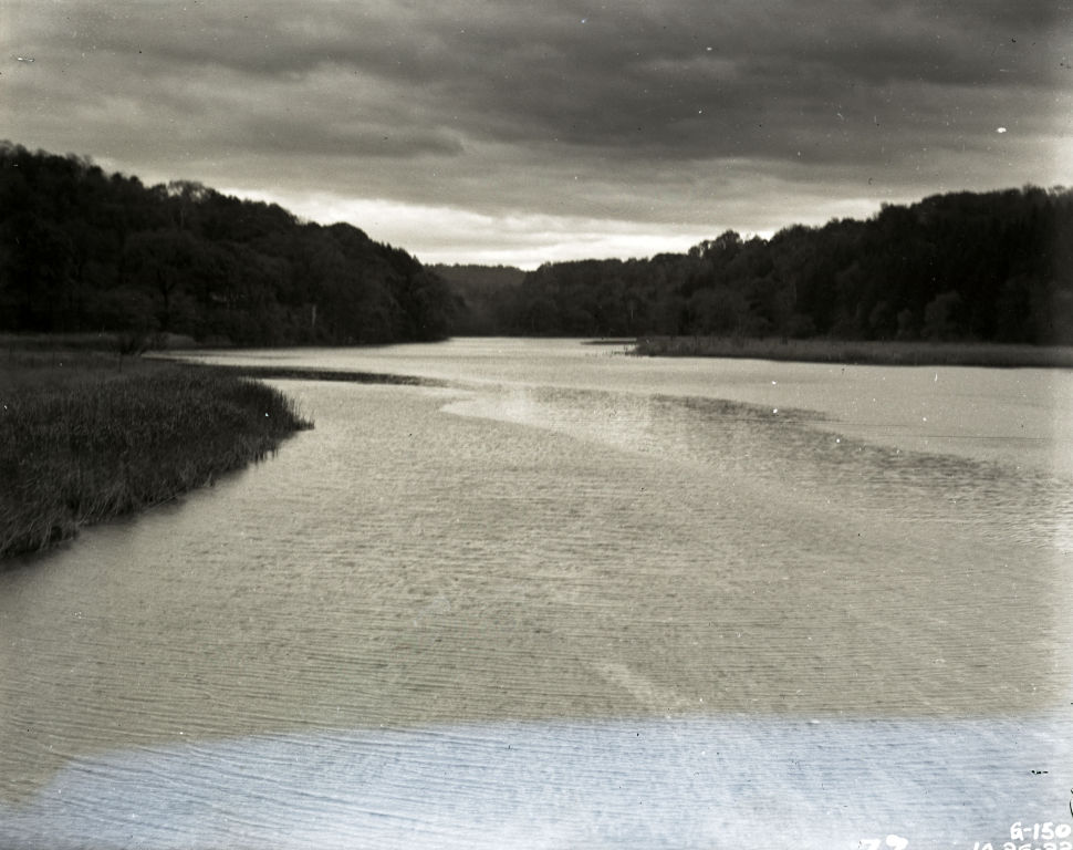
Westchester County Archives, Park Commission Collection
Croton River landscape 1923
A black and white photograph of the Croton River, showing a serene landscape with a river flowing through a wooded area. The riverbank on the left side of the image has tall grasses and reeds. The…
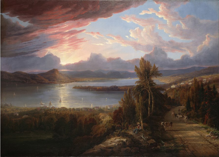
Wikimedia Commons
Hudson River North to Croton Point — Robert Havell Jr. (1851)
Oil painting by Robert Havell Jr. showing the Hudson River looking north toward Croton Point. Havell, famous for engraving Audubon's 'Birds of America,' painted this during the peak of…

crotonhistory.org — https://crotonhistory.org/2012/01/24/croton-river-circa-1908/
Croton River, circa 1908
[Article content from crotonhistory.org - see URL for full text and images]
Date: Various
Source: crotonhistory.org — https://crotonhistory.org/2012/01/24/croton-river-circa-1908/
License: Used with attribution; consult crotonhistory.org for permissions
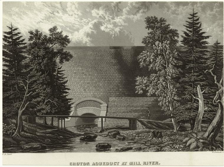
NYPL Mid-Manhattan Picture Collection / Wikimedia Commons
Croton Aqueduct at Mill River — Tower/Bennett Engraving (c.1843)
Engraving by F.B. Tower (artist), W. Bennett (engraver) showing the Croton Aqueduct crossing at Mill River. From Tower's 'Illustrations of the Croton Aqueduct' (1843), the definitive visual record…
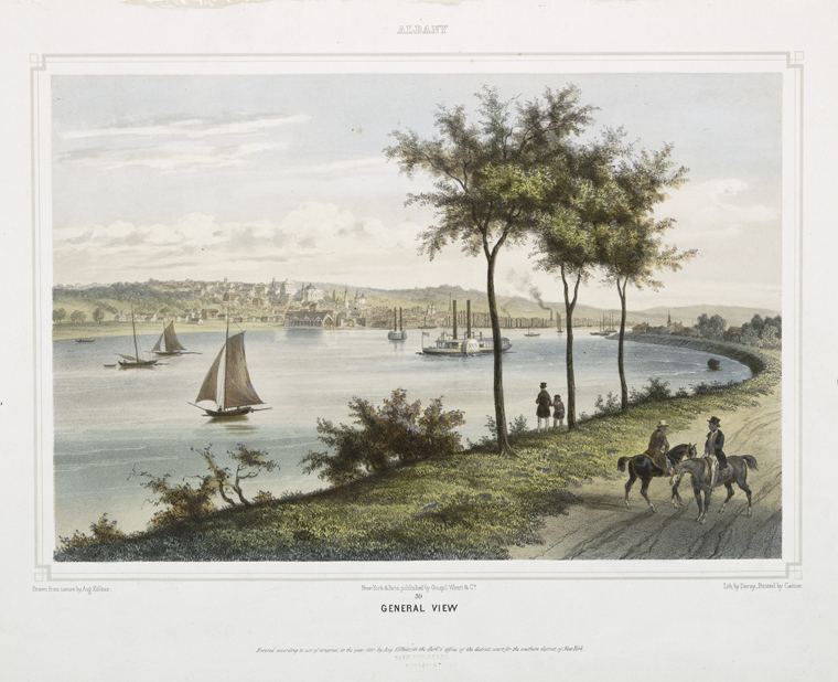
NYPL, Illustrations of the Croton Aqueduct (F.B. Tower)
Croton Aqueduct Harlem River Crossing
The image depicts the Croton Aqueduct crossing the Harlem River, showcasing the original High Bridge design with stone arches. The scene includes a river with sailboats and steamboats, a grassy bank with trees, and people…