History / Search
1784 passages in 153 source items for “aqueduct”
Collection
All
🏹 Indigenous Peoples & Archaeology
📜 Colonial & Dutch Records
📖 Westchester County Histories
🏘️ Croton Local History
🏛️ Government Documents
NY Heritage Digital Collections
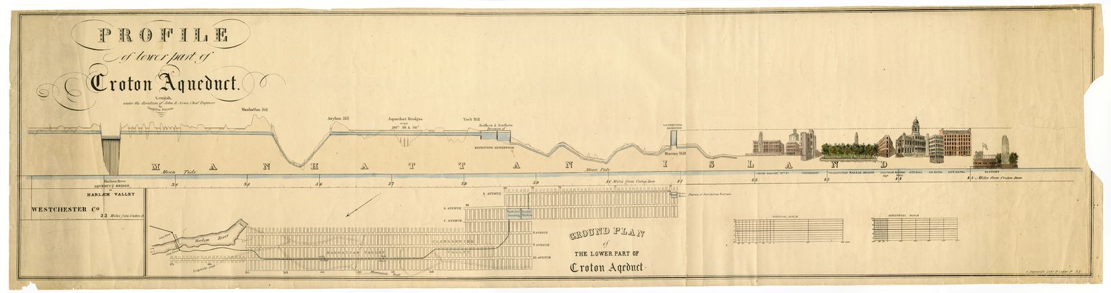
Croton Aqueduct — Croton Aqueduct Profile
Engineering drawing or plan from the Croton Aqueduct collection.
Date: c.1842
Location: Croton-on-Hudson, NY
Type: diagram
Subjects: Croton Aqueduct, engineering drawing, aqueduct profile
Source: NY Heritage Digital Collections
License: Public domain
NY Heritage Digital Collections
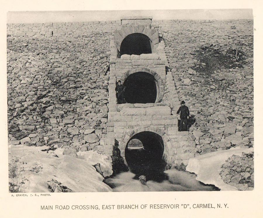
Croton Aqueduct — Croton Aqueduct Reservoir D 1895
Engineering drawing or plan from the Croton Aqueduct collection.
Date: 1895
Location: Croton-on-Hudson, NY
Source: NY Heritage Digital Collections
License: Public domain
NY Heritage Digital Collections
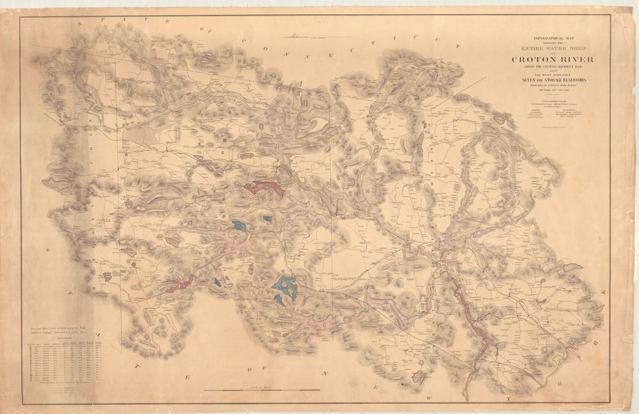
Croton Aqueduct — Croton Aqueduct Map Watershed 1858
Engineering drawing or plan from the Croton Aqueduct collection.
Date: 1858
Location: Croton-on-Hudson, NY
Type: map
Subjects: Croton River, watershed, reservoirs, topographical map
Source: NY Heritage Digital Collections
License: Public domain
en.wikipedia.org
(Redirected from Old Croton Aqueduct ) Aqueduct in New York (1842–1955) For the current aqueduct which superseded this one, see New Croton Aqueduct . United States historic place Old Croton Aqueduct U.S. National Register of Historic Places U.S.
Show 8 of 235 matching passages
Old Croton Aqueduct §2
— (Redirected from Old Croton Aqueduct ) Aqueduct in New York (1842–1955) For the current aqueduct which superseded this one, see New Croton Aqueduct . United States historic place Old Croton Aqueduct U.S. National Register of Historic Places U.S.
Old Croton Aqueduct §36
— route of the aqueduct. It crosses the lawn of the Lyndhurst estate, following the aqueduct's easement. The trail enters New York City on the eastern side of Van Cortlandt Park ; [ 7 ] the aqueduct runs through the Bronx under Aqueduct…
Old Croton Aqueduct §73
— Aqueduct Trail" . Friends of the Old Croton Aqueduct . Archived from the original on October 8, 2011 . Retrieved October 6, 2011 . ^ "Old Croton Aqueduct Trail Map" (PDF) . New York State Office of Parks, Recreation and Historic Preservation .
Old Croton Aqueduct §54
— Landmark by the American Society of Civil Engineers in 1975. [ 25 ] The interior of the Old Croton Aqueduct has been documented by explorers including Miru Kim and historian Steve Duncan. [ 26 ] Aqueduct Walk [ edit ] Main article: Aqueduct Walk
Old Croton Aqueduct §89
— Croton Aqueduct, Sing Sing Kill Bridge, Spanning Aqueduct Street & Broadway, Ossining, Westchester County, NY ", 18 photos, 4 measured drawings, 2 data pages, 2 photo caption pages HAER No. NY-112, " Old Croton Aqueduct, Mill River Culvert, U.S.
Old Croton Aqueduct §66
— through History (Old Croton Aqueduct Staste Park brochure). ^ a b c "Old Croton Aqueduct Trail" . New York City Department of Parks and Recreation . Retrieved September 19, 2007 . ^ Nemo, Leslie (March 1, 2023). "Aqueduct met New York City's need for
Old Croton Aqueduct §58
— section of aqueduct with brick walls and exposed ceiling A gate at Ossining Weir to close the aqueduct off for maintenance A valve at Ossining Weir to redirect water out of the aqueduct Ventilating tower No. 16, Irvington (May 2005…
Old Croton Aqueduct §59
— …15, Tarrytown (November 2020) Trail sign marking the Old Croton Aqueduct State Historic Park in Tarrytown Section of the Old Croton Aqueduct State Historic Park in Sleepy Hollow 135th St Croton Aqueduct Gatehouse in New York City is listed on…
aqueduct.org
Forgotten New York Street Scenes (Old Croton Aqueduct) To see Library of Congress images of the Aqueduct – type “Croton aqueduct” into the search field at top right.)
Show 8 of 25 matching passages
History of the Old Croton Aqueduct §24
— Forgotten New York Street Scenes (Old Croton Aqueduct) To see Library of Congress images of the Aqueduct – type “Croton aqueduct” into the search field at top right.)
History of the Old Croton Aqueduct §17
— Weschester County section of the Old Croton Aqueduct, between Croton Gorge Park and the Yonkers-New York City line. This 26.2-mile portion of the total 41-mile Aqueduct route became the Old Croton Aqueduct State Historic Park, a…
History of the Old Croton Aqueduct §14
— and how The Friends of the Old Croton Aqueduct rescued it HERE ) The Aqueduct in the 20th Century Until 1955 the Old Croton Aqueduct brought water to New York City. (The northernmost portion reopened in 1987 and continues to supply…
History of the Old Croton Aqueduct §23
— more info in Aqueduct History, check out these links: A short bibliography compiled by Tom Tarnowsky NYC DEP’s Flickr zccount about NYC Water John Bloomfield Jervis Papers at the Jervis Public Library Croton Aqueduct History – NY Historical Society
History of the Old Croton Aqueduct §9
— civic rejoicing. Print from Friends of the Old Croton Aqueduct – more about the celebration at Croton History The trail is virtually as old as the Aqueduct. It was created for reasons of security – to prevent local opponents of this massive,
History of the Old Croton Aqueduct §13
— the home of James Bremner, the principal superintendent of the Aqueduct, north of New York City. The house is a contributing feature of the aqueduct trail, which was designated a National Historic Landmark in 1992. (Read more about the Keeper…
History of the Old Croton Aqueduct §15
— of Ossining.) Though the Aqueduct was built to meet the city’s needs for 100 years, the supply was soon insufficient due to the spiraling population growth to which it contributed. The New Croton Aqueduct, triple the size and much…
History of the Old Croton Aqueduct §22
— Gotham: A History” by Gerard Koeppel, 2000, Princeton University Press. An archive of Aqueduct material, donated by William Lee Frost to Croton-on-Hudson’s Historical Reference Room (Municipal Building), may also be consulted; call 914-271-4574. For
Internet Archive (ldpd_11290324_000), p.12
Croton Aqueduct Engraving — Tower (1843)
Engraving from F.B. Tower's 'Illustrations of the Croton Aqueduct' showing a section of the 41-mile aqueduct system that brought fresh water from the Croton River to New York City.
Date: 1843
Location…
NYPL / F.B. Tower, Illustrations of the Croton Aqueduct
Croton Aqueduct Tower near Ossining
The image shows a tower plate of the Croton Aqueduct route near Ossining, then known as Sing Sing. The aqueduct's route follows the landscape contours to maintain a gentle gravity-fed downward grade. A…
Tower, Fayette B. Illustrations of the Croton Aqueduct. New York: Wiley and Putnam, 1843.
…Aqueduct Bridge for Road-way,
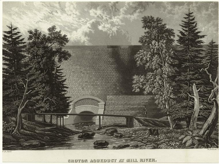
Croton Aqueduct at Mill-River, ... -
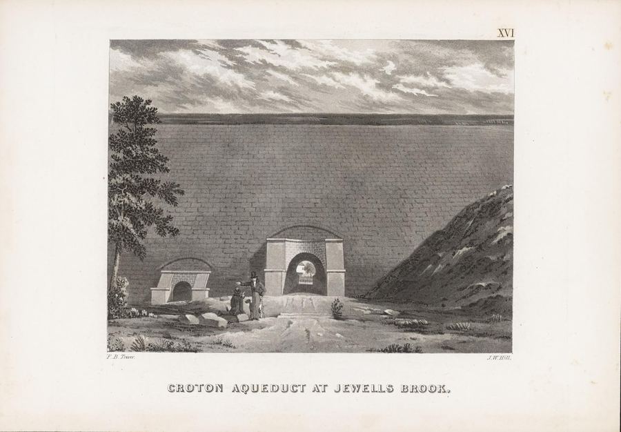
Croton Aqueduct at Jewell's Brook,
Croton Aqueduct at Hastings,
Croton Aqueduct at Yonkers,
...
-----
- -
Show 8 of 237 matching passages
Illustrations of the Croton Aqueduct §2
— …Aqueduct Bridge for Road-way,
Croton Aqueduct at Mill-River, ... -
Croton Aqueduct at Jewell's Brook,
Croton Aqueduct at Hastings,
Croton Aqueduct at Yonkers,
...
-----
- -
Illustrations of the Croton Aqueduct §3
— ------
Isometrical View of Culvert, 90
Tunnel and Gate Chamber at the head of the Aqueduct, - - 92
------
View above the Croton Dam, 95
Entablature over the entrance to the Aqueduct, - 96
View below the Croton Dam,
Croton Aqueduct at Sing-Sing…
Illustrations of the Croton Aqueduct §21
— …A fourth
Aqueduct was also constructed for this city, but there is
some doubt whether it was built by the Romans.
Aqueduct of Mount Pila.
This Aqueduct was built by Claudius, who was born at
Lyons, to conduct water to…
Illustrations of the Croton Aqueduct §149
— …This
valley is four fifths of a mile wide where the Aqueduct
meets it, and the depression is 102 feet below the plane of
Aqueduct grade. Here was an opportunity for constructing a work of
architectural beauty and boldness by…
Illustrations of the Croton Aqueduct §118
— In crossing Harlem River there is a fall of 2 feet more
than there would have been had the Aqueduct continued
across with its regular inclination : this extra fall will afford
an opportunity to adjust the number and capacity of…
Illustrations of the Croton Aqueduct §38
— …Part of this ancient construction, consisting of two arches
substantially built, still exists, near the modern Aqueduct.
The Aqueduct bridge over the valley of Arcueil has twentyfive arches, is 72 feet high and 1,200 feet in length.
In the…
Illustrations of the Croton Aqueduct §111
— …In such a position the Aqueduct is perhaps less secure than in those before described. Where the soil is wet from springs, and the
formation clay, there is danger of slides ; and in rainy seasons there is danger from the…
Illustrations of the Croton Aqueduct §151
— …is an enlarged view of one of the bridges
and a portion of the foundation wall and Aqueduct adjacent
to it. The Aqueduct has a cast iron lining over the bridges
like that described at the Sing Sing Kill.
These…
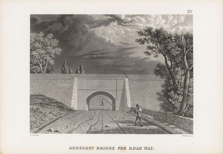
Internet Archive (ldpd_11290324_000), p.18
Aqueduct Detail — Tower (1843)
Engraving from Tower's Croton Aqueduct illustration book showing construction or engineering details.
Date: 1843
Type: engraving
Subjects: Croton Aqueduct, bridge, roadway, man, trees, stone wall
Source: Internet Archive (ldpd_11290324_000), p.18
License: Public…
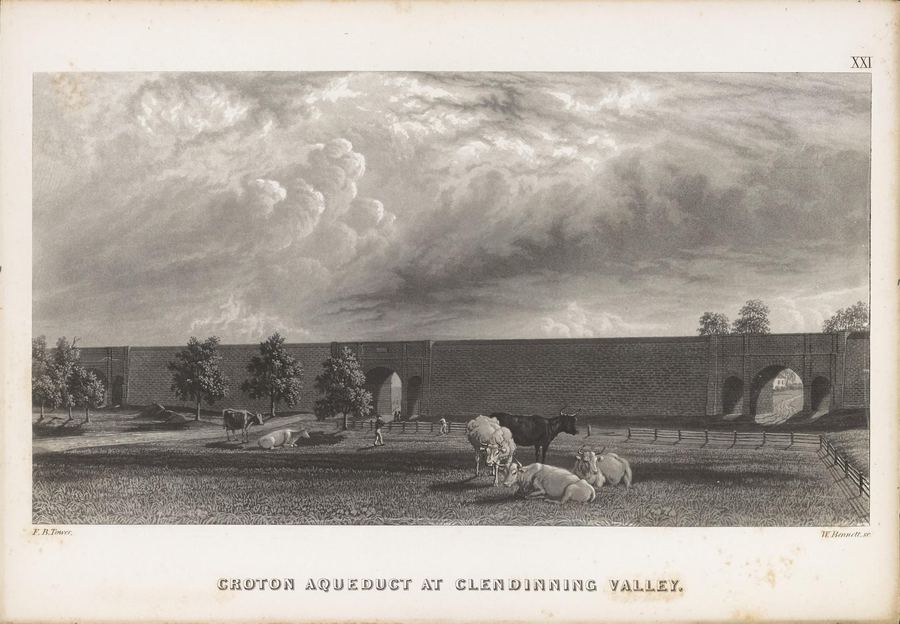
Internet Archive (ldpd_11290324_000), p.8
Aqueduct Section Engraving — Tower (1843)
Detailed engraving of the Croton Aqueduct infrastructure from Tower's illustration book.
Date: 1843
Type: engraving
Subjects: Croton Aqueduct, Clendinning Valley, livestock, brick structure, cloudy sky
Source: Internet Archive (ldpd_11290324_000), p.8
License…
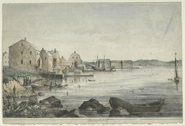
NYPL / F.B. Tower, Illustrations of the Croton Aqueduct
Croton Aqueduct near York Hill
The image shows a 19th-century engraving of the Croton Aqueduct near York Hill in upper Manhattan. The scene depicts a body of water with boats and a shoreline featuring buildings. The aqueduct's structure…
NYPL Mid-Manhattan Picture Collection / Wikimedia Commons
Croton Aqueduct at Mill River — Tower/Bennett Engraving (c.1843)
Engraving by F.B. Tower (artist), W. Bennett (engraver) showing the Croton Aqueduct crossing at Mill River. From Tower's 'Illustrations of the Croton Aqueduct' (1843), the definitive visual record…
crotonhistory.org
This is a detail of the Croton area from the map The Route of the New Aqueduct from Central Park to Croton Dam . . . prepared by the Aqueduct Commission in 1884. The route of the new aqueduct tunnel is the dark…
Show 8 of 10 matching passages
New Croton Aqueduct Map 1884 §0
— This is a detail of the Croton area from the map The Route of the New Aqueduct from Central Park to Croton Dam . . . prepared by the Aqueduct Commission in 1884. The route of the new aqueduct tunnel is the dark…
New Croton Aqueduct Map 1884 §9
— on Pinterest (Opens in new window) Pinterest Share on Tumblr (Opens in new window) Tumblr Share on LinkedIn (Opens in new window) LinkedIn Like Loading... Related Published April 26, 2012 February 17, 2013
New Croton Aqueduct Map 1884 §5
— Highland Turnpike Bridge is next and was long-gone by 1884. This bridge was first built circa 1812 as part of the Highland Turnpike, which ran through the Hudson Highlands. Because bridge construction was still primitive in the early 1800s…
New Croton Aqueduct Map 1884 §6
— tended to wash out due to severe storms or spring freshets. Indeed, in 1836 the New York Legislature reported that “the bridge over the Croton river upon [the Highland Turnpike] has been entirely carried away.” High Bridge , the covered bridge…
New Croton Aqueduct Map 1884 §4
— “Wagon Bridge” in 1898. New York State eventually removed the old span, replacing it with the “Van Cortlandt Bridge” in 1922. This was the main route into Croton for more than 40 year until it was demolished in 1964—despite…
New Croton Aqueduct Map 1884 §1
— across the bottom from Croton Dam. One of the many interesting things about this map is that the New Croton Dam—then in the planning stages—is shown at the Quaker Bridge location. For more information on the Quaker Bridge…
New Croton Aqueduct Map 1884 §3
— was definitely there in 1884. The Van Cortlandt Manor Bridge , which spanned the mouth of the river and went up the road where Shoprite is today, had several incarnations and was there when this map was made. “Long Bridge” was…
New Croton Aqueduct Map 1884 §2
— fascinating aspect of the map is that it shows two bridges across the lower Croton River that didn’t actually exist in 1884, when the map was made. Moving from left to right the bridges shown are: Hudson River Railroad…
NY Heritage Digital Collections
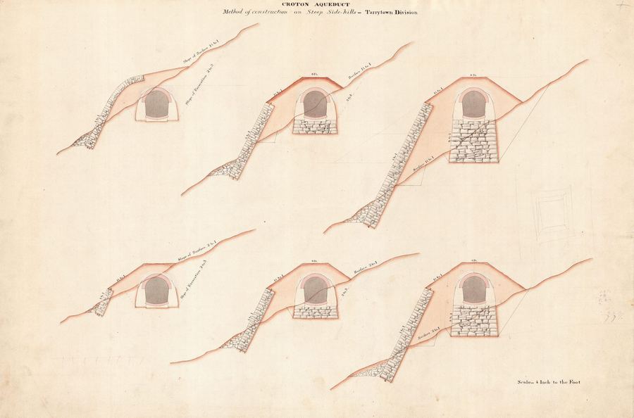
Croton Aqueduct Construction on Steep Hills
Engineering diagram showing the method of construction on steep side hills for the Croton Aqueduct, Tarrytown Division. The diagram includes six cross-sectional views of the aqueduct's construction on varying slopes, with labels…
Internet Archive (ldpd_11290324_000), p.15
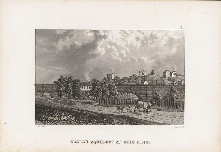
Croton Aqueduct at Sing Sing
An engraving showing a section of the Croton Aqueduct system, specifically at Sing Sing (now Ossining), with a man leading oxen along a road in front of a stone wall and arches of the aqueduct…
Library of Congress
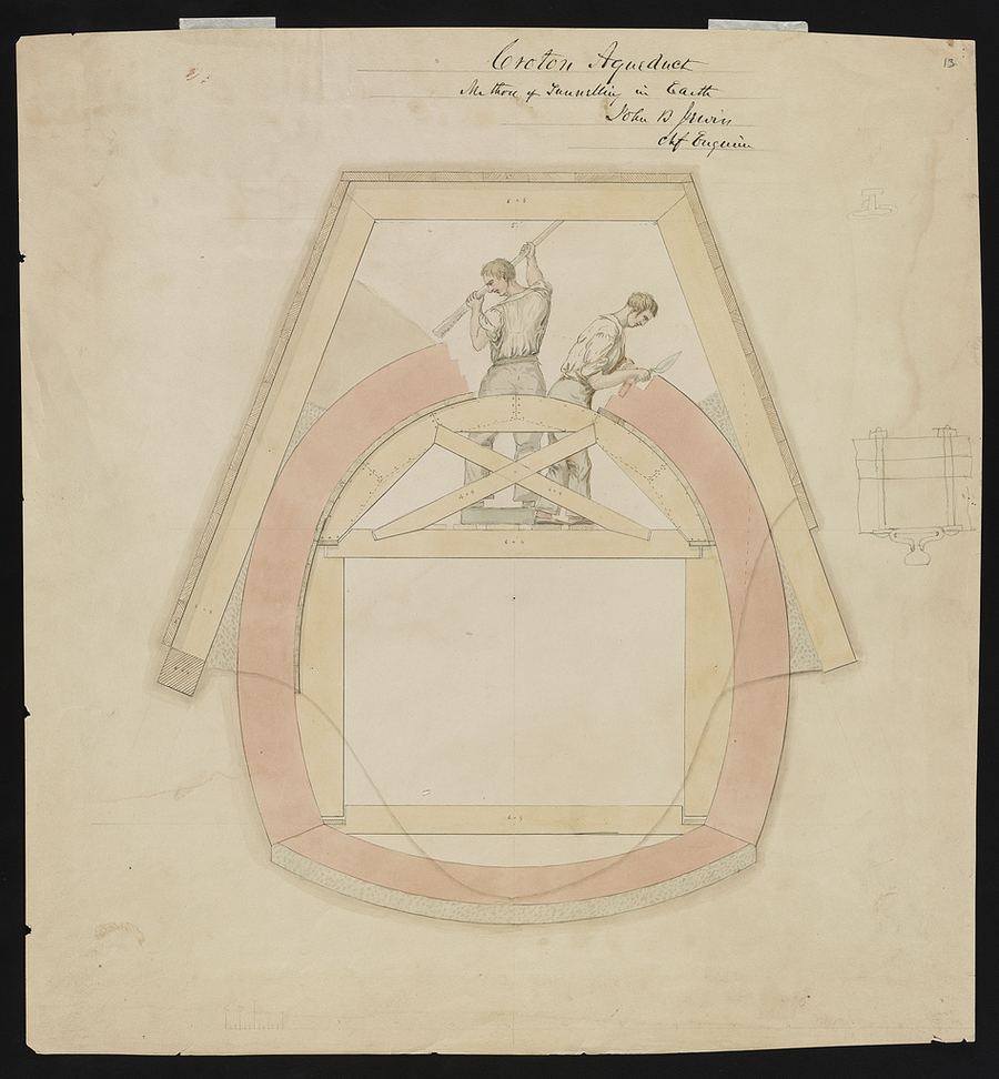
Croton Aqueduct Tunnelling Method — Jervis Drawing (1837)
Ink and watercolor engineering drawing by chief engineer John B. Jervis showing workers tunnelling through earth during the construction of the Croton Aqueduct. Jervis designed the entire 41-mile system, including the dam…
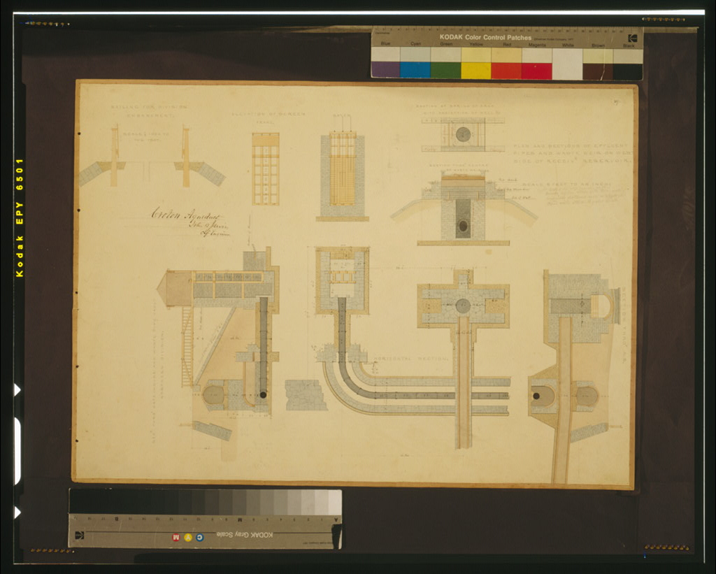
Library of Congress
Croton Aqueduct Plans and Sections — Jervis Drawing (1837)
Ink and watercolor rendering of aqueduct cross-sections, elevations, and construction plans by chief engineer John B. Jervis. Shows the precise engineering behind the gravity-fed system that carried Croton water to…
crotonhistory.org
line shows the line of the old aqueduct and in the full black line shows the course of the new aqueduct.” The Old and New Croton Aqueduct System, looking south from Putnam County. Scientific American , 1887. Click to enlarge. When…
Show 8 of 16 matching passages
Birds Eye Views Of The Croton Aqueduct 1879 1887 §8
— line shows the line of the old aqueduct and in the full black line shows the course of the new aqueduct.” The Old and New Croton Aqueduct System, looking south from Putnam County. Scientific American , 1887. Click to enlarge. When…
Birds Eye Views Of The Croton Aqueduct 1879 1887 §0
— Here are two priceless “bird’s eye” views of the Croton Aqueduct, made eight years apart during the period when New York City was rapidly outgrowing the capacity of what we now call the Old Croton Aqueduct. One map looks…
Birds Eye Views Of The Croton Aqueduct 1879 1887 §15
— Scientific American Published August 31, 2013 August 31, 2013
Birds Eye Views Of The Croton Aqueduct 1879 1887 §1
— metropolis in 1879—straining the water supply system with its unrelenting growth. The other looks south—to the future—showing both the path of the New Croton Aqueduct tunnel and the then-planned location (later abandoned) of “the most massive
Birds Eye Views Of The Croton Aqueduct 1879 1887 §9
— published the New Croton Aqueduct tunnel was three years away from completion and the dam was still in the planning stages. 2 The narrow part of the Croton, where today’s Quaker Bridge crosses the river, was one of several…
Birds Eye Views Of The Croton Aqueduct 1879 1887 §4
— …It was a stunning achievement for the time.” 1 The map is so detailed that it shows all three major components of the Old Croton Aqueduct in New York City: High
Birds Eye Views Of The Croton Aqueduct 1879 1887 §10
— extensive planning—including test borings, cost estimates and structural plans. The site was eventually abandoned in favor of one further up-river, but in 1887 Quaker Bridge was the favored location. For Crotonites the detail showing the bridge is
Birds Eye Views Of The Croton Aqueduct 1879 1887 §14
— window) Facebook Share on X (Opens in new window) X Share on Pinterest (Opens in new window) Pinterest Share on Tumblr (Opens in new window) Tumblr Share on LinkedIn (Opens in new window) LinkedIn Like Loading... Related Tagged Quaker Bridge
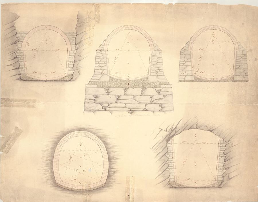
NY Heritage Digital Collections
Croton Aqueduct Tunnel Sections
Engineering drawing showing various cross-sectional views of a tunnel, likely part of the Croton Aqueduct system. The drawing includes five different sections with detailed measurements and annotations.
Date: c.1842
Location: Croton-on-Hudson, NY…
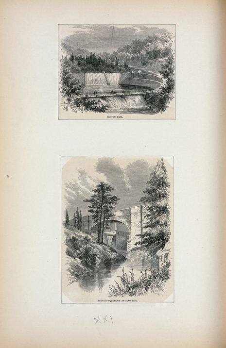
NYPL, Emmet Collection
Croton Dam; Croton Aqueduct at Sing Sing (1880)
View of the Old Croton Dam and the aqueduct near Sing Sing (now Ossining). From the Emmet Collection. Shows the dam and surrounding landscape nearly 40 years after the aqueduct's completion…
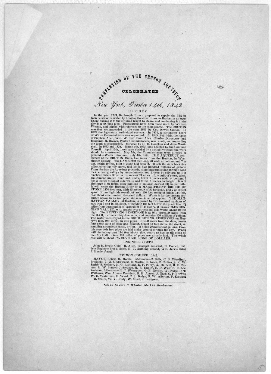
Library of Congress, Rare Book Division
Completion of the Croton Aqueduct — Broadside (1842)
Printed broadside celebrating the completion of the Croton Aqueduct, October 14, 1842. These broadsides were distributed during the celebration parade along with copies of the Croton Ode by George Pope Morris.
Date: October…
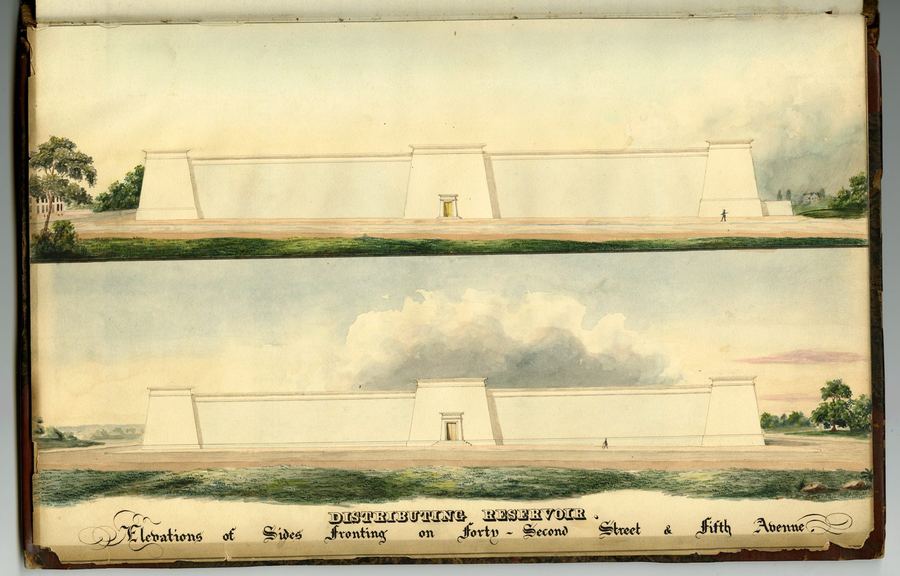
NY Heritage Digital Collections
Croton Aqueduct Distributing Reservoir Elevations
An architectural drawing showing two elevations of the Croton Aqueduct Distributing Reservoir, with detailed views of the structure's sides fronting on Forty-Second Street and Fifth Avenue.
Date: c.1842
Location: Croton-on-Hudson…
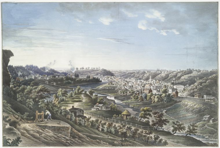
NYPL, Illustrations of the Croton Aqueduct (F.B. Tower)
Croton Aqueduct at Sing Sing Kill — F.B. Tower (1843)
Tower's plate showing the Croton Aqueduct crossing the Sing Sing Kill (creek) near present-day Ossining. The aqueduct was carried over streams and valleys on stone arches and bridges…
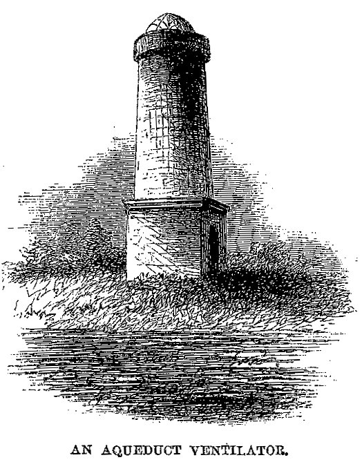
Harper's New Monthly Magazine / Wikimedia Commons
An Aqueduct Ventilator — Harper's Magazine (1860)
Engraving of a ventilation tower along the Croton Aqueduct. These distinctive stone towers, spaced at intervals along the 41-mile route, allowed air circulation in the underground tunnel. They became landmarks along the…
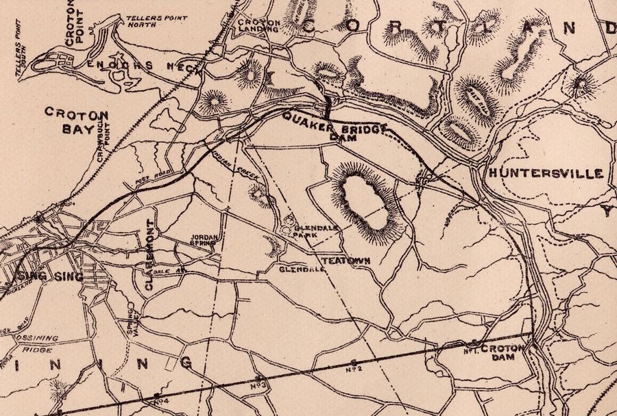
crotonhistory.org — https://crotonhistory.org/2012/04/26/new-croton-aqueduct-map-1884/
New Croton Aqueduct Map, 1884
[Article content from crotonhistory.org - see URL for full text and images]
Date: Various
Source: crotonhistory.org — https://crotonhistory.org/2012/04/26/new-croton-aqueduct-map-1884/
License: Used with attribution; consult crotonhistory.org…
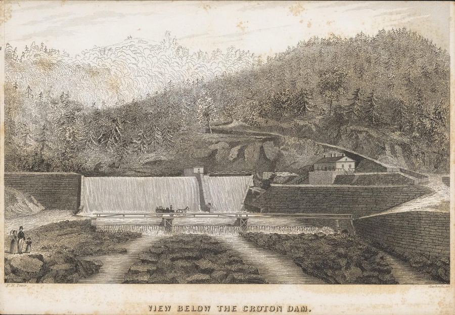
Internet Archive (ldpd_11290324_000)
Frontispiece — Illustrations of the Croton Aqueduct
Frontispiece engraving from Tower's 1843 book documenting the Croton Aqueduct system with detailed illustrations.
Date: 1843
Type: engraving
Subjects: Croton Dam, spillway, bridge, horse-drawn carriage, people
Source: Internet Archive (ldpd_11290324_000…
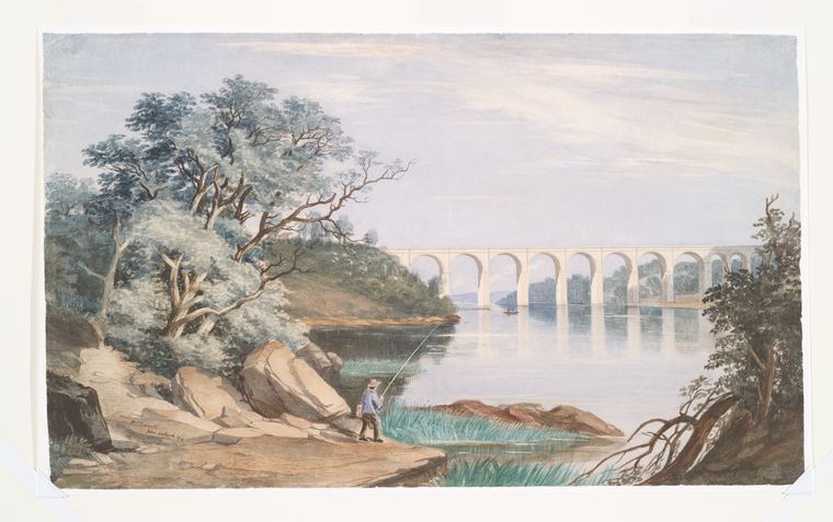
NYPL, I.N. Phelps Stokes Collection
Croton Aqueduct over Harlem River
Lithograph showing the Croton Aqueduct spanning the Harlem River, with a man fishing in the foreground on the riverbank, surrounded by trees and rocks.
Date: 1844
Location: Harlem River, New York City
Type: lithograph
Subjects…
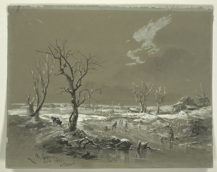
NYPL / F.B. Tower, Illustrations of the Croton Aqueduct
Croton Aqueduct Approach to Manhattan
The image depicts a landscape with a large, bare tree in the foreground and a body of water in the background. A structure resembling a small house or shed is visible on the right side…
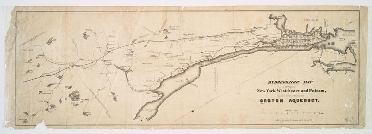
NYPL, Lionel Pincus and Princess Firyal Map Division
Hydrographic Map Showing Line of Croton Aqueduct (1846)
Detailed map from the NYPL Map Division showing the complete route of the Croton Aqueduct from the Croton Dam through Westchester County to Manhattan. Compiled under the direction of chief engineer John…
crotonhistory.org
Published March 30, 2013 March 30, 2013
Show 7 matching passages
Croton Aqueduct Puzzles §6
— Published March 30, 2013 March 30, 2013
Croton Aqueduct Puzzles §2
— puzzle companies of the Victorian era and sold several “sliced” puzzle sets, including Sliced Animals and Sliced Birds. The series was popular enough that it was copied by another company, resulting in an 1883 trademark infringement lawsuit ( Selchow
Croton Aqueduct Puzzles §3
— v. Baker ), which Selchow won. In 1880 John Righter became a partner and the company name was changed to Selchow & Righter. The firm remained a top game and puzzle company into the twentieth century, remembered by aficionados for Parcheesi, Scrabble
Croton Aqueduct Puzzles §5
— Share on X (Opens in new window) X Share on Pinterest (Opens in new window) Pinterest Share on Tumblr (Opens in new window) Tumblr Share on LinkedIn (Opens in new window) LinkedIn Like Loading... Related Tagged Ephemera High Bridge (Harlem…
Croton Aqueduct Puzzles §4
— and Trivial Pursuit. Many thanks to Etsy seller paintedpony99 for permission to use the box image. Share this: Print (Opens in new window) Print Email a link to a friend (Opens in new window) Email Share on Facebook (Opens in…
Croton Aqueduct Puzzles §0
— Click on the images to enlarge them. November 1877 ad These two nineteenth century puzzles, showing the Old Croton Dam and High Bridge, were part of a set called Sliced Objects, published by E. G. Selchow & Co., circa 1867 to…
Croton Aqueduct Puzzles §1
— in a box (shown below) along with puzzles of other New York landmarks—the Bethesda Fountain, St. Paul’s Church, the statue of Washington in Union Square—and puzzles for coach, yacht, engine and other words. Selchow was one of…