History / Search
684 passages in 684 source items for “Blue Mountain, before the trail map”
Collection
All
🏹 Indigenous Peoples & Archaeology
📜 Colonial & Dutch Records
📖 Westchester County Histories
🏘️ Croton Local History
🏛️ Government Documents
No passages matched all of those words — showing passages that match any of them, best matches first.

Bolton, Indian Paths in the Great Metropolis (1922), Map II
…Published by Ohman Map Co., N.Y.
Date: 1922
Location: Lower Manhattan
Type: map
Subjects: map, indigenous trails, Lenape place names, Lower Manhattan
Source: Bolton, Indian Paths in the Great Metropolis (1922), Map II
License: Public domain

Bolton, Indian Paths in the Great Metropolis (1922), Plate II
…An Indian Path Through Shorakapkok — Bolton (1922)
Photograph showing an actual indigenous trail through the Shorakapkok area of northern Manhattan (Inwood Village), Station 16, Map V. The snow-covered path through bare winter trees shows how these trails, worn by…

Bolton, Indian Paths in the Great Metropolis (1922), Plate I
…at the northern tip of Manhattan (Station 14, Map I). This rocky promontory where the Little Red Lighthouse now stands was a key landmark on the indigenous trail system. The Lenape used this narrow point to cross the Hudson River…
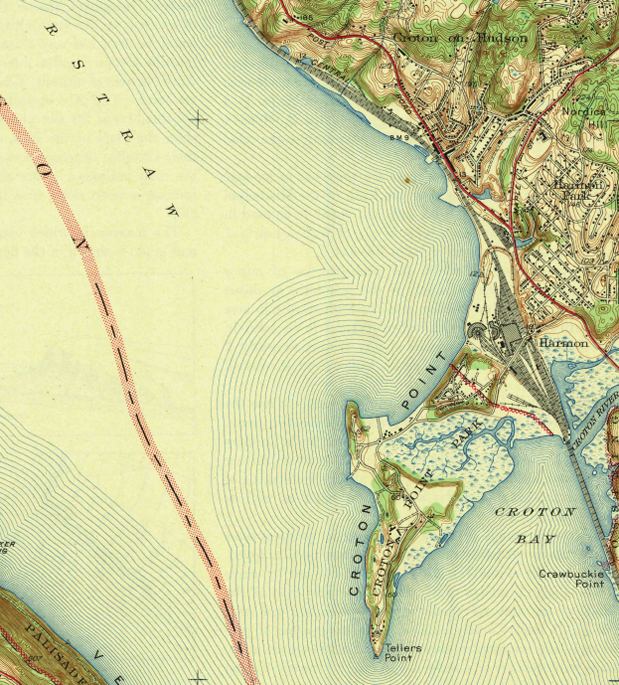
crotonhistory.org — https://crotonhistory.org/2013/06/13/u-s-geographical-survey-map-1943/
…Geographical Survey Map, 1943
This article examines a 1943 topographic map of the Haverstraw Quadrangle, surveyed in 1938 by the U.S. Department of the Interior Geological Survey. The map reveals Croton's landscape before Route 9 construction.
Key observations…
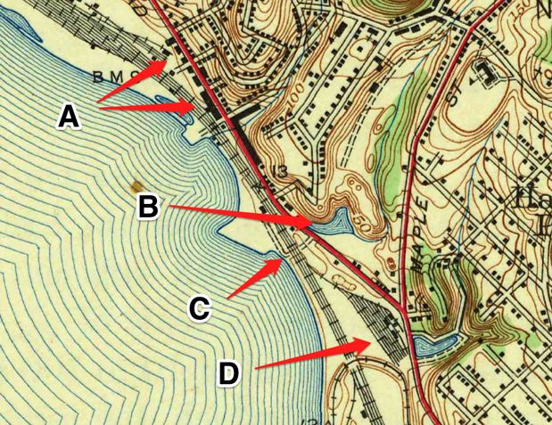
crotonhistory.org — https://crotonhistory.org/2013/06/13/u-s-geographical-survey-map-1943/
…Geographical Survey Map, 1943
This article examines a 1943 topographic map of the Haverstraw Quadrangle, surveyed in 1938 by the U.S. Department of the Interior Geological Survey. The map reveals Croton's landscape before Route 9 construction.
Key observations…
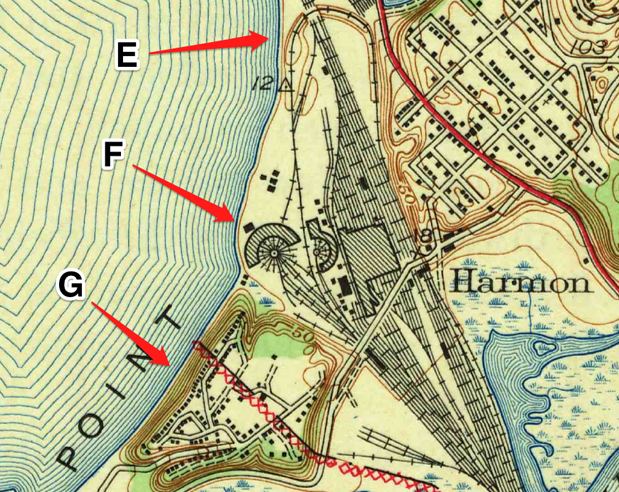
crotonhistory.org — https://crotonhistory.org/2013/06/13/u-s-geographical-survey-map-1943/
…Geographical Survey Map, 1943
This article examines a 1943 topographic map of the Haverstraw Quadrangle, surveyed in 1938 by the U.S. Department of the Interior Geological Survey. The map reveals Croton's landscape before Route 9 construction.
Key observations…

crotonhistory.org — https://crotonhistory.org/2012/03/11/bear-mountain-bridge-circa-1924/
Bear Mountain Bridge, circa 1924
[Article content from crotonhistory.org - see URL for full text and images]
Date: Various
Source: crotonhistory.org — https://crotonhistory.org/2012/03/11/bear-mountain-bridge-circa-1924/
License: Used with attribution; consult crotonhistory.org…
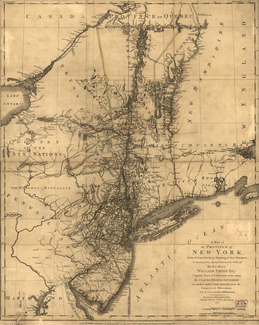
Library of Congress
Province of New York Map (1776)
Map of the Province of New York during the Revolutionary War era, showing Westchester County — the contested 'Neutral Ground' between American and British lines.
Date: 1776
Type: map
Subjects: river, county, ocean, map grid…

crotonhistory.org — https://crotonhistory.org/2013/06/11/census-map-of-croton-1935/
Census Map of Croton, 1935
Census Map of Croton, 1935
This post presents three detailed sections from a 1935 census map of the Town of Cortlandt, which accompanied the 1940 census. The map details focus on three areas: Croton, Harmon…
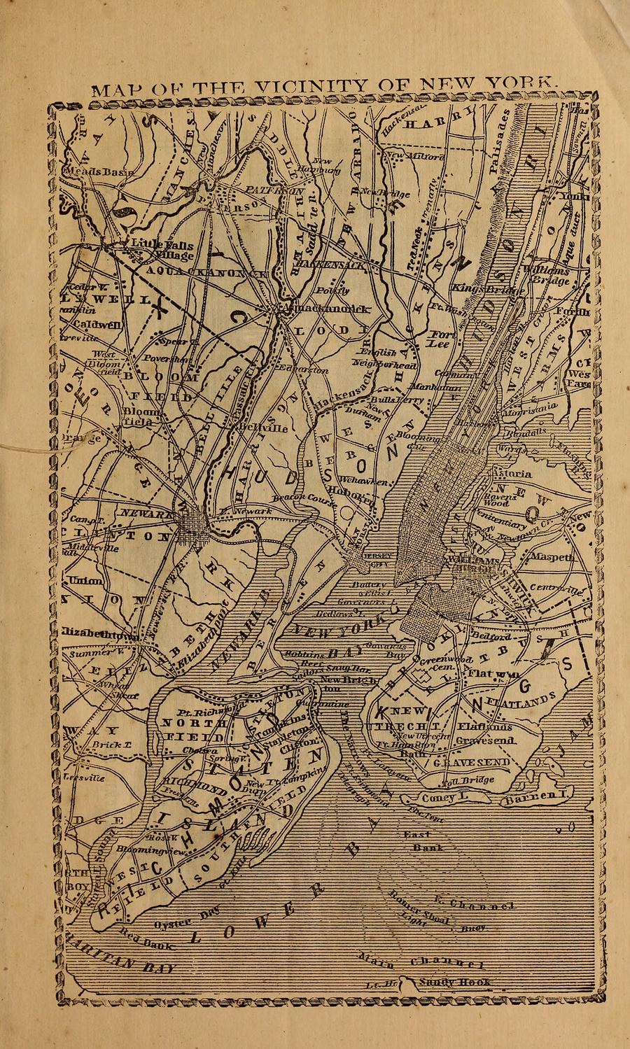
Internet Archive / Wikimedia Commons
Map of the Vicinity of New York
A detailed map showing the vicinity of New York City, including parts of New Jersey and New York State. The map displays various locations, roads, and bodies of water in the area.
Date…
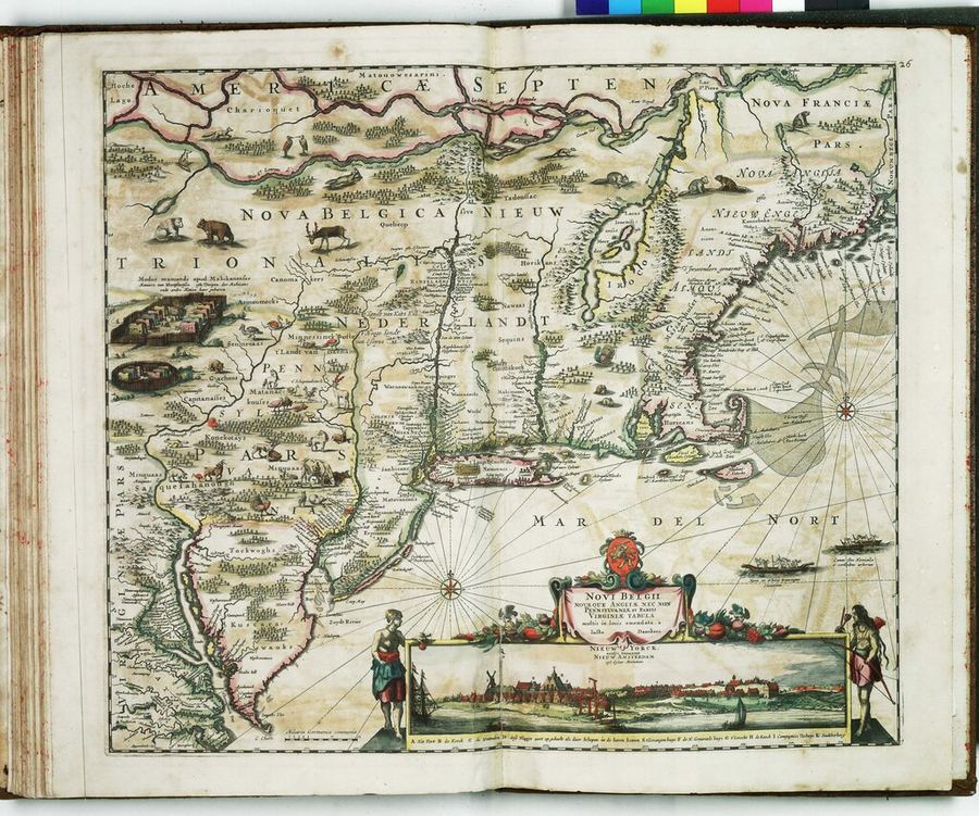
Royal Maritime Museum / Wikimedia Commons
Visscher Map of New Netherland
Nicolaes Visscher map of New Netherland showing Dutch colonial settlements and Native American territories along the Hudson River.
Date: c. 1655-1685
Type: map
Subjects: river, map, Native American territories, Dutch colonial settlements, ships, animals…

NYPL / F.B. Tower, Illustrations of the Croton Aqueduct
San Francisco Map (1848)
Detailed map of San Francisco in September 1848, showing the city's layout, waterways, and surrounding geography.
Date: 1843
Location: Harlem River, New York City
Type: map
Subjects: San Francisco, map, waterways, city layout
Source: NYPL…

NY Heritage Digital Collections
Putnam County Map 1931
Historical map from the NY Heritage digital collections.
Date: 1931
Location: Croton-on-Hudson, NY
Type: map
Subjects: Putnam County, roads, townships, villages, Taconic Parkway, parks, Croton Water System, railroads, brooks
Source: NY Heritage Digital Collections…

NY Heritage Digital Collections
Topo Map of Putnam County 1889
This is a topographic map of Putnam County, New York, from 1889. It shows the area around Croton Watershed with various lakes, reservoirs, and geographical features. The map includes labeled locations such as Croton…
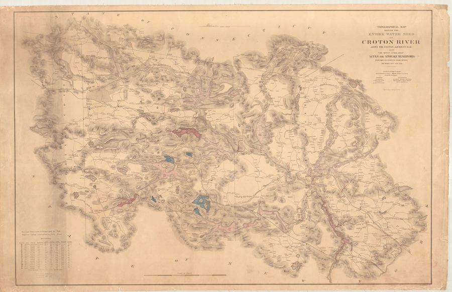
NY Heritage Digital Collections
Croton Aqueduct — Croton Aqueduct Map Watershed 1858
Engineering drawing or plan from the Croton Aqueduct collection.
Date: 1858
Location: Croton-on-Hudson, NY
Type: map
Subjects: Croton River, watershed, reservoirs, topographical map
Source: NY Heritage Digital Collections
License: Public domain

Library of Congress
Sanborn Fire Insurance Map — Croton-on-Hudson (1911)
Sanborn map showing Croton-on-Hudson in 1911, after the completion of the New Croton Dam and during the Harmon development era.
Date: 1911
Location: Croton-on-Hudson, NY
Type: map
Subjects…
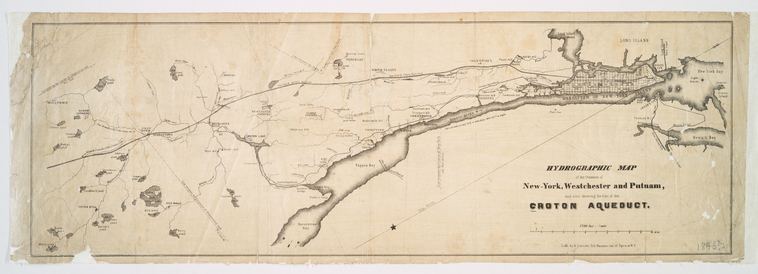
NYPL, Lionel Pincus and Princess Firyal Map Division
Hydrographic Map Showing Line of Croton Aqueduct (1846)
Detailed map from the NYPL Map Division showing the complete route of the Croton Aqueduct from the Croton Dam through Westchester County to Manhattan. Compiled under the direction of chief engineer John…

Westchester County Archives, Park Commission Collection
Plateau Camp Colony Croton Point Park Map
A detailed map of the Plateau Camp Colony in Croton Point Park, Westchester County, NY, created by the Westchester County Park Commission in February 1925. The map shows the layout of the camp…
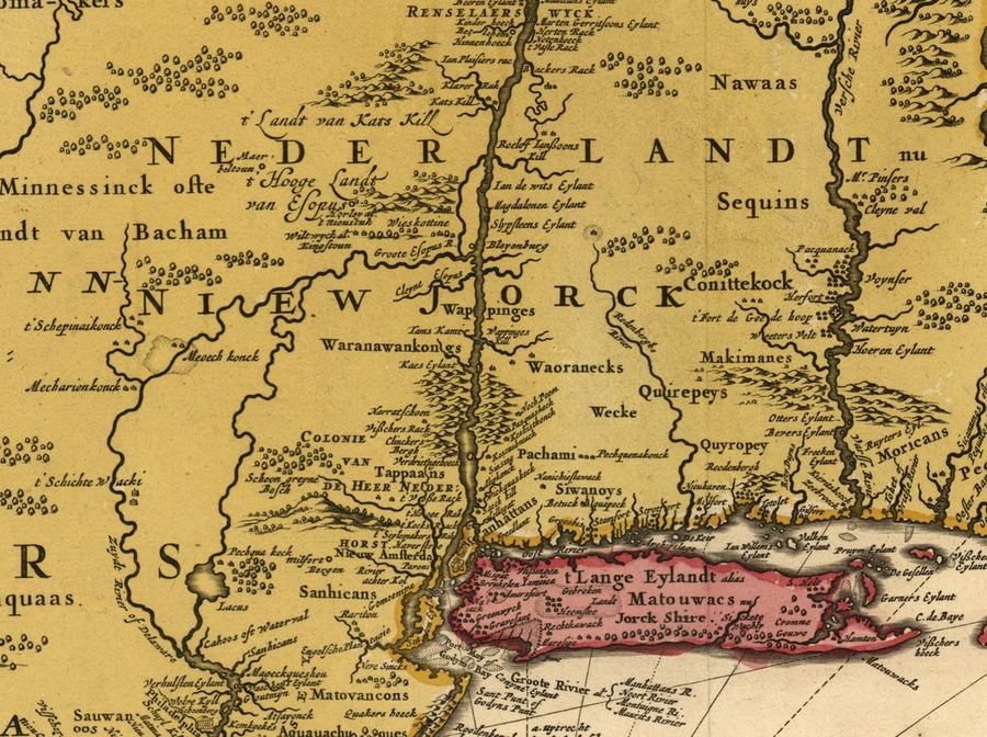
Library of Congress
Novi Belgii Map Excerpt (1685)
Detail from a 1685 edition of the Novi Belgii map showing the Hudson River valley including the area near present-day Croton Point where the Kitchawank had their fortress Navish.
Date: 1685
Type: map
Subjects…

Library of Congress
Sanborn Fire Insurance Map — Croton-on-Hudson (1935)
Sanborn map of Croton-on-Hudson in 1935, showing the village after Prohibition's repeal.
Date: 1935
Location: Croton-on-Hudson, NY
Type: map
Subjects: Croton-on-Hudson, Hudson River, Croton Bay…

Library of Congress
Sanborn Fire Insurance Map — Croton-on-Hudson (1903)
Sanborn fire insurance map showing the street layout and buildings of Croton-on-Hudson in 1903, during the vineyard and early railroad era.
Date: 1903
Location: Croton-on-Hudson, NY
Type: map…
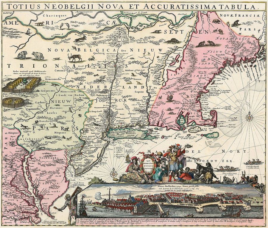
Wikimedia Commons
New Netherland and New England Map (1662)
This map shows the eastern coast of North America, focusing on New Netherland (present-day New York) and New England. It features the Hudson River, Native American territories, and early Dutch and English…
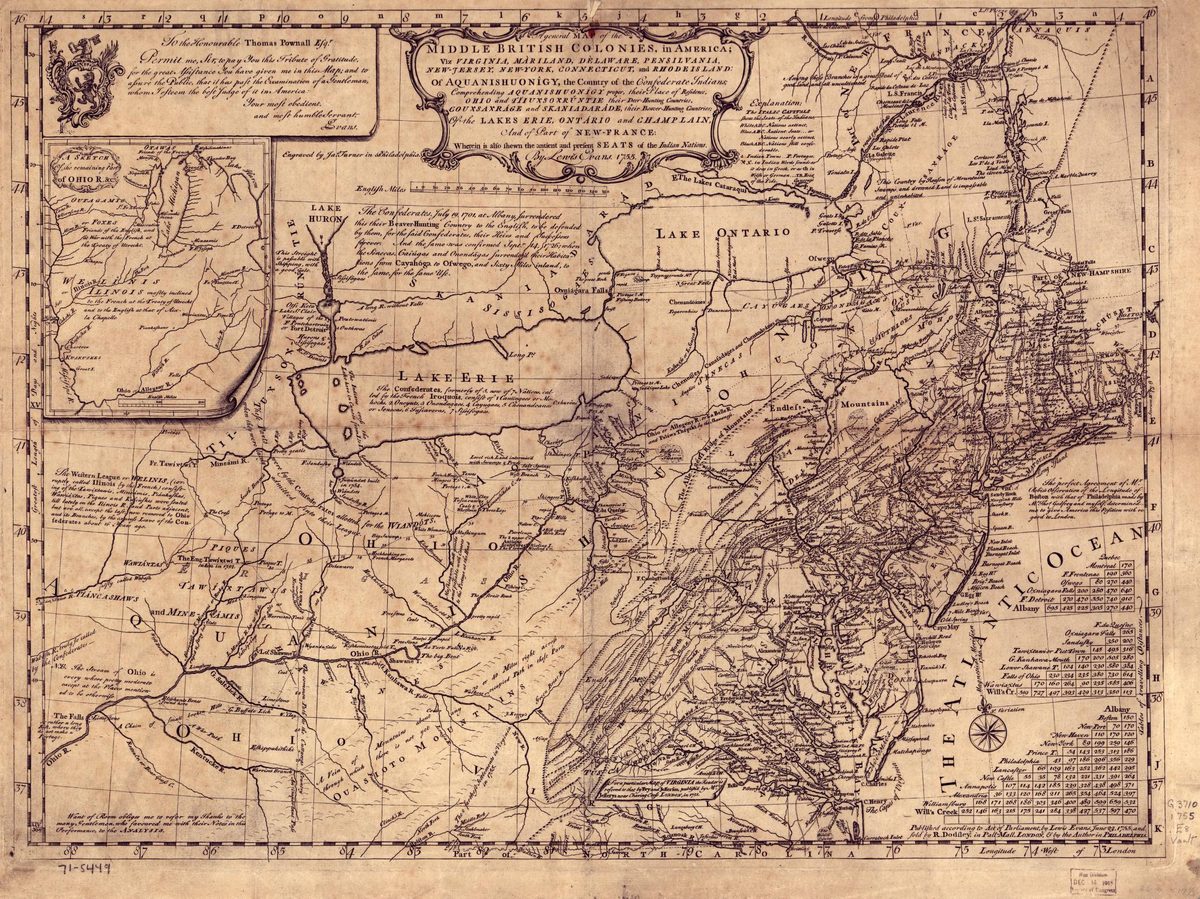
Library of Congress
Mitchell Map of the Middle British Colonies (1755)
John Mitchell's 1755 map of the Middle British Colonies, showing Westchester County and the Hudson Valley during the colonial era.
Date: 1755
Location: Middle British Colonies
Type: map
Subjects: map, colonial…
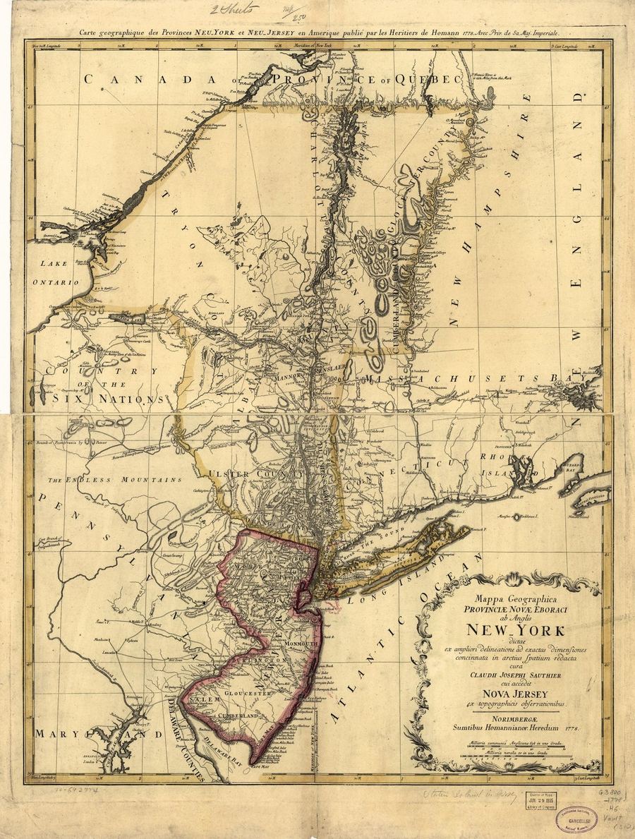
Wikimedia Commons
Sauthier Map — Province of New York (1778)
Claude Joseph Sauthier's detailed 1778 map of the Province of New York showing Westchester County, the Van Cortlandt and Philipse manors, and the Croton River area during the Revolution.
Date: 1778
Type…

Library of Congress
Sanborn Fire Insurance Map — Croton-on-Hudson (1924), Sheet 1
Sanborn map of Croton-on-Hudson during the Prohibition era (1924). The village had several roadhouses and speakeasies along the Albany Post Road.
Date: 1924
Location: Croton-on-Hudson, NY…
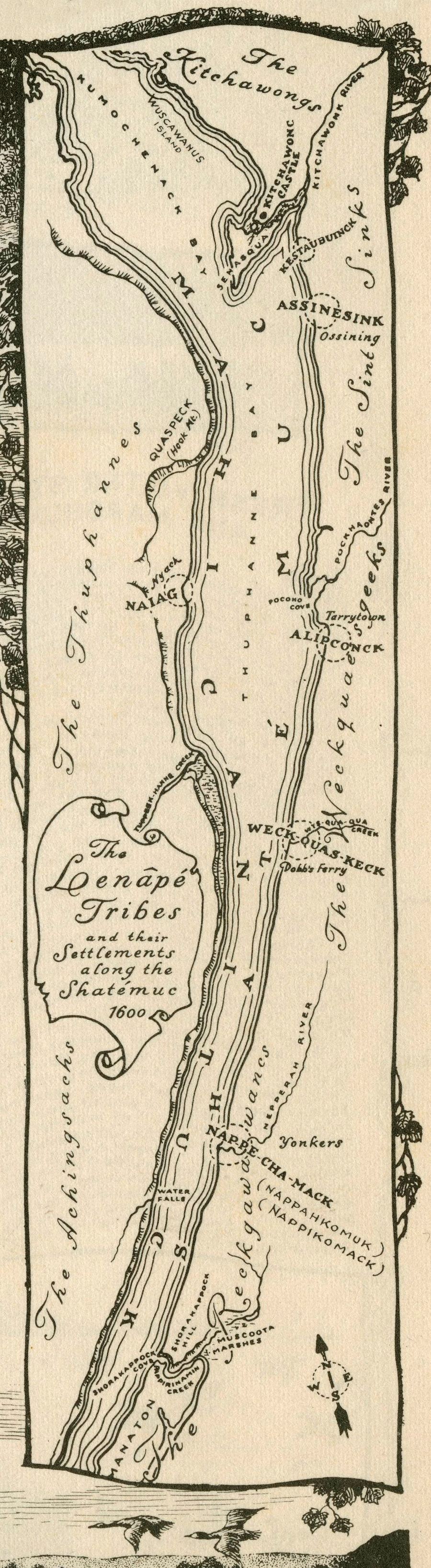
crotonhistory.org — https://crotonhistory.org/2013/02/13/lenape-settlement-map-circa-1600/
Lenape Settlement Map, circa 1600
In 1950, Theodore J. Cornu created a historical map depicting "the lower Hudson River as the Lenape saw it, circa 1600," published in Hudson Valley Echoes Issue 1.
Date: Various
Source: crotonhistory.org — https://crotonhistory…