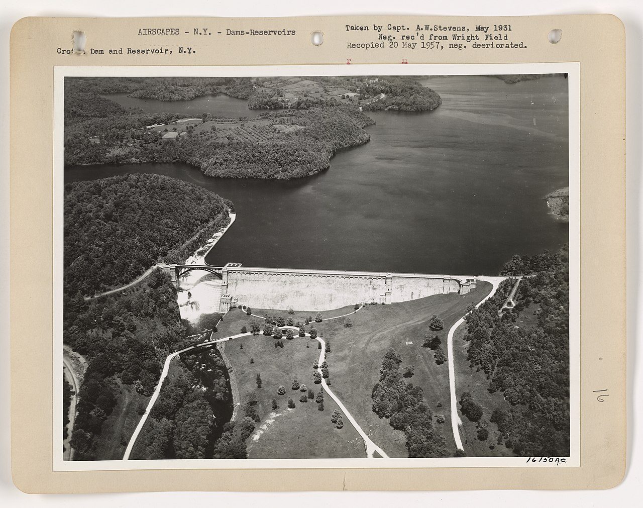
Aerial photograph of the New Croton Dam and reservoir by Capt. A.W. Stevens of the U.S. Army, 1931. Shows the dam from above with the full scope of the reservoir visible.
In this story · 3 sections
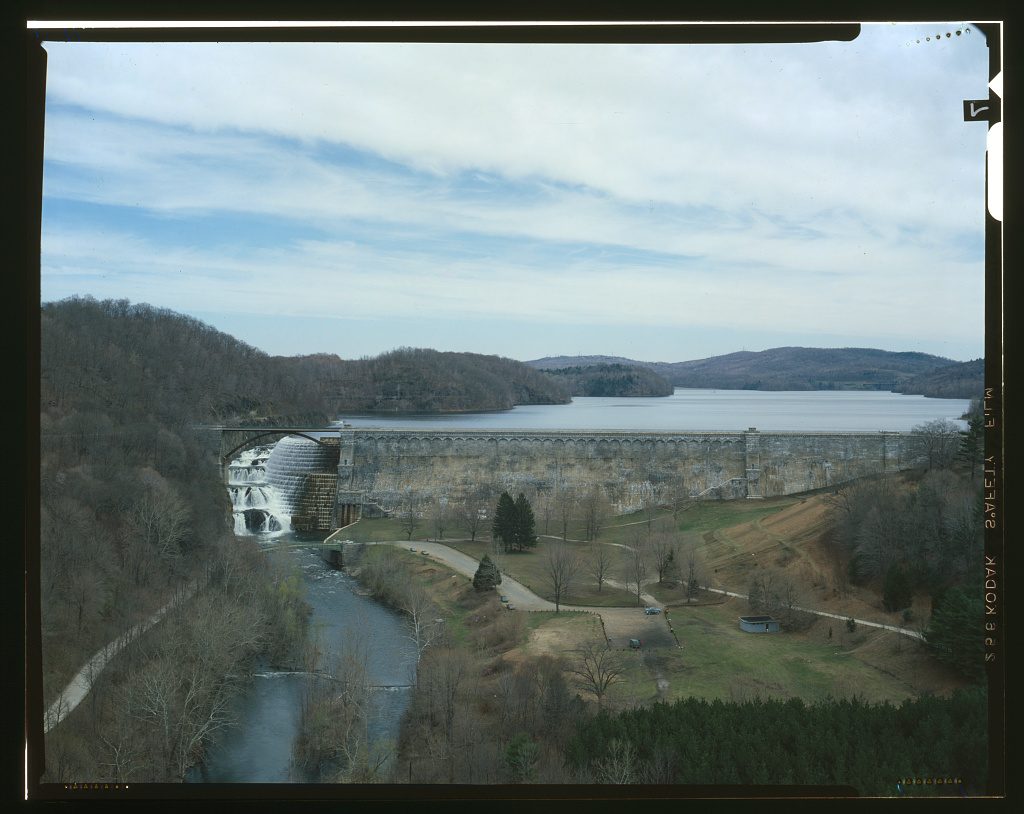
At Croton Gorge Park, the New Croton Dam occupies the view. The wall, spillway and water below it bring the scale of New York City's water system into a landscape that people can walk through. The 97-acre county park is also an entry point into histories of construction, labor and the valley changed by the reservoir.
Which dam, and which date?
The New Croton Dam belongs to a later expansion of the system that first brought Croton water to Manhattan in 1842. It should not be confused with the original dam, which was submerged by the new reservoir. New York City's Department of Environmental Protection dates the New Croton Reservoir's entry into service to 1905. DEP reservoir history
Construction dates, an in-service date and a ceremonial completion date answer different questions. Accounts of the project use different endpoints. Our earlier attempt to make 1907 the one definitive answer was too categorical. For the reservoir's operation, this article follows its operator, DEP; a particular construction milestone needs its own engineering record.
DEP describes a reservoir approximately nine miles long, with a full capacity of about nineteen billion gallons. It is the final collecting reservoir in the Croton system. Those measurements describe stored water and its role in the supply network—not the inflated twenty-square-mile water surface claimed in an earlier version of this article. DEP
The labor behind the view
The dam was also a workplace. Construction brought immigrant workers, lodging houses and businesses into the Croton valley. A later local account describes the settlement called the Bowery or Little Italy and the power of labor brokers, or padrones, over workers' earnings and accommodation. That retrospective source is useful, but should not stand in for every worker's experience. [1] [2]
Contemporary newspaper dispatches bring the April 1900 strike into sharper focus. They record a military encampment, the fatal shooting of Sergeant Robert Douglass and arrests in the workers' settlements. They also reveal how much of the reporting came through officials and soldiers. [3]
Read the workers' settlement and the strike reporting alongside the engineering history. The workers belong in the account of the finished structure.
The park and the aqueduct
Westchester County identifies Croton Gorge as a 97-acre park at the dam's base, with access to the Old Croton Aqueduct trail. The road across the crest is open to pedestrians and closed to vehicles. County park information
Croton Gorge is at the northern end of the aqueduct's Westchester park route. Following the trail south connects the later dam with the older water system. The two works share a river and a purpose but belong to different stages of the city's growth. Continue with Twenty-six miles of water and walking.
The view is impressive without ranking the dam against pyramids, walls or every other stone structure in the world. Its history becomes clearer through concrete comparisons: the earlier and later reservoirs, the construction site and the park, the city's water demand and the lives of the people who met it.
Updated October 16, 2026. Corrected the reservoir’s dimensions, distinguished its 1905 entry into service from construction milestones, and corrected the aqueduct trail’s direction. Unsupported world rankings and construction claims have been removed.
Citations
Numbered citations link to the cited passage in the archive.
Follow the evidence
Sources are linked beside the claims they support. Numbered notes open archived passages; named links open the cited record or publication.